Taylor Made Hike

Hike to the Summit of Santa Rosa's Taylor Mountain

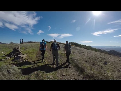
Hiking during the holiday season is a great way to gain a little perspective … or a big perspective, if you decide to hike at Taylor Mountain Regional Park and Open Space Preserve, where the views are huge. This locals’ favorite near Santa Rosa is worth a visit for anyone in the Bay Area, especially in the cooler months.

With over 1,000 acres and hiking trails leading to a panoramic 1,400-foot summit, Taylor Mountain is gloriously exposed—meaning you get fantastic vistas en route. There are two entry points to the park. We recommend starting from the Petaluma Hill Road entrance. Take the Red Tail Trail either direction from the parking lot, winding up through oak woodlands for about a mile before breaking into an open meadow. The last section is short and steep, and the summit is a sweeping reward of grand views, including the Santa Rosa Plain, Bennett Valley, Hood Mountain, and Mount Saint Helena.

From this vantage you’ll get a bird’s-eye view of the devastation from the wine country wildfires, but you’ll also be heartened to see that there is still so much beauty in the vast landscape of rolling hills that were spared from the fires. Perspective indeed.

BONUS: From the summit of Taylor Mountain you’ll see a vineyard to the south. That’s nearby Matanzas Creek Winery, where the outdoor setting is one of the best in wine country, and that’s not just the wine talking!

This hike starts at Taylor Mountain’s Petaluma Hill Road entrance (3820 Petaluma Hill Rd., Santa Rosa, map). Start by going left on the Redtail Trail, then take the Connector Trail, followed by a right onto the Western Route, and then a right onto the Eastern Route to the summit. Return the way you came. Dog-friendly!

Trending Stories NorCal

View all Stories
  1. Woman with her arms outstretched to the rolling hills scenery while on a rock outcrop at Barnabe Peak in Samuel P Taylor Sate Park in Marin

    Barnabe Bonanza

    Sure, there are higher mountains in Marin (Mount Tam) and easier ascents (Mount Burdell), but is there a more expansive North Bay view? Barnabe Peak in Samuel P. Taylor State Park offers a glorious panorama including Mount Tam, Mount Diablo, and Mount St. Helena.

    View
  2. Tamtastic Sunset

    Sure, the East Peak of Mount Tam is absolutely spectacular at sunset, but some magic-hour enthusiasts head to a nearby spot, Trojan Point, for a little more personal space in their panoramic viewings.

    View
  3. Hiker on the SCA trail in Marin Headlands with view of the Golden Gate Bridge

    Headlands Over Heels

    People come from all over the world to get a glimpse of the Golden Gate Bridge. Get a dramatic and novel view of the bridge without all the people on this moderate 6-mile hike in the Marin Headlands.

    View

Trending Stories SoCal

View all Stories
  1. Lagoon Swoon

    We all love an underdog story, especially in the shadow of the greats. Enter a truly SoCal coastal version: Malibu Lagoon State Beach. Though situated next to Surfrider Beach, a fa

    View
  2. Woman hiking the San Onofre Bluffs Loop Trail to San Onofre State Beach in San Diego County

    Bluffing Good!

    Lovely coastline, beautiful beaches, unique geological history, and picturesque sandstone cliffs with limited foot traffic in San Diego County? Head to San Onofre State Beach and the 5-mile San Onofre Bluffs Loop Trail.

    View
  3. Can We Get a Whoop Whoop!

    City, mountain, and ocean views all in one hike? Whoop whoop! It’s no surprise the the Kenter Fire Road and Whoop-de-Doos Trail (a combo of fire road and singletrack) is a favorite among local mountain bikers and hikers alike.

    View