This Coyote

Mountain Bike or Hike to Coyote Peak in Santa Teresa County Park
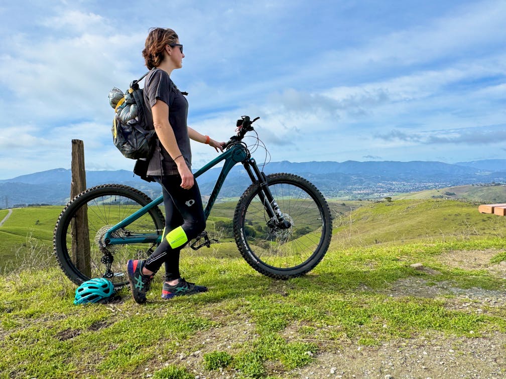
Woman on her mountain bike overlooking the scenery of the Santa Cruz mountains at San Jose's Santa Teresa County Park

Combine a workout with rewarding vistas by hiking or biking Coyote Peak in San Jose’s Santa Teresa County Park. The 4.1-mile loop up Coyote Peak is spring green with rewarding vistas of both the Diablo Range and the Santa Cruz Mountains.

Starting from the Santa Teresa Golf Club parking lot, you’ll pass through the small gate at the southern edge of the lot and begin ascending into the hills. The trail is steep, but free of large rocks, making it a slow and steady climb. Turn right at the intersection with Ohlone Trail, and then left onto Coyote Peak Trail.

As you gain elevation, the southern end of Silicon Valley swims into view, surrounded by the emerald expanse of springtime hills. At the intersection with Boundary Trail, bear left onto the final stretch toward the summit. This open grassland is perfect for animal lovers as it’s a home to grazing cows, ground squirrels, deer, foxes, and bobcats.

Mountain bike rider on Coyoke Peak Trail overlooking the Silicon Valley and Santa Clara Valley below, with the Santa Cruz Mountains in the background

After nearly 1.5 miles of steady climbing you’re at Coyote Peak summit! Marked by a large antenna, the 1,156-foot high summit also features a vista point where cyclists and hikers can relax on a bench and soak up the surrounding views. The Santa Clara Valley stretches out to the northwest, while the Santa Cruz Mountains are a gorgeous backdrop to the south. Lucky visitors may even catch sight of one of the peak’s namesake coyotes.

Bike rider smiling at camera on a wide open dirt trail on Coyote Peak Trail in Santa Teresa County Park in San Jose

As you exit the summit area, turn right onto Coyote Peak Trail to begin descending. The trail is a mix of dirt and gravel, but just as steep as the ascent, so hold on to those brakes as you fly down the mountain (and don’t be ashamed to get off your bike and walk it down if you need to). Bear left onto Hidden Springs Trail, which provides the last views of the city before plunging back into the trees.

Turn right onto Ohlone Trail, a narrow dirt path that winds through the sun-dappled forest and past a scenic pond. Pass the intersection with Coyote Peak Trail, then turn left to return to the parking lot.

The Santa Teresa Golf Club parking lot is located on Polvadero Drive in San Jose.

Santa Teresa County Park (map) is open from 8 a.m. until sunset. The trails are open to hikers, cyclists, and equestrians. Dog-friendly.

Story and photos by Heather Werner, @heath.er.wer.ner

Trending Stories NorCal

View all Stories
  1. Bear Hug

    This 5.5-mile loop through Coyote Lake-Harvey Bear Ranch County Park explores one of the newest segments of the acclaimed Bay Area Ridge Trail, one redolent with trees ranging from madrone and manzanita to buckeye and blue elderberry (with a bubbly post-hike bonus).

    View
  2. Field of Light at Sensorio in Paso Robles

    Light This Way

    Hidden in the bucolic hills of Paso Robles lies one of the greatest light shows on earth. The lighted art exhibition, Sensorio, is as if the rainbow magic of the aurora borealis was plucked from the sky and planted in the fields.

    View
  3. Bikers and walkers on the Bay Area Ridge Trail with the Golden Gate Bridge behind them

    National Park City Walk

    See San Francisco the way locals do by hiking the Presidio, a national park right in the city! Wooded trails, secluded beaches, and epic views of the Golden Gate Bridge feature on this 5.5-mile out-and-back on the Bay Area Ridge Trail. It’s a lovely slice of the City by the Bay.

    View
  4. Hike top Angel Island Mount Livermore San Francisco Bay

    Good Heavens

    The 4-mile hike to the top of Angel Island offers Bay-mazing scenery. Some people claim you get a five-bridge view: Richmond-San Rafael, Bay, Golden Gate, San Mateo-Hayward, and Dumbarton bridges.

    View

Trending Stories SoCal

View all Stories
  1. Sponsored

    Tram to Cool Treks

    Elevate your fun, getting whisked from palm trees to alpine wilderness on the world’s largest rotating tramcar. The Palm Springs Aerial Tramway transports you up and away on a 2.5-mile scenic route from the desert floor to the refreshing wilderness of Mount San Jacinto State Park.

    View
  2. Coming Up Roses

    Looking to spice up your hiking life? Give your partner a rose—Mount Rose! The 10-mile out-and-back peak hike goes up to one of the grandest views in all of Lake Tahoe. Get ready f

    View
  3. A group of people clamored around the summit marker at Mission Peak in the Bay Area

    Your Mission Is Less Crowded

    Mission Peak is one of the Bay Area’s most popular mountains, with many hikers climbing every weekend. Skip the crowds with this 6-mile loop up the less-traveled southern route.

    View
  4. Bucks Up!

    Come on in, the water is beautiful. Whether you like swimming, kayaking, stand-up paddling, or heading out on a bigger boat, Bucks Lake is a high mountain haven that’s easy to access, blissfully uncrowded, and surrounded by sandy beaches, picnic areas, pines, and aspens.

    View