Diamonds of Diablo

Hike to waterfalls at Mount Diablo State Park
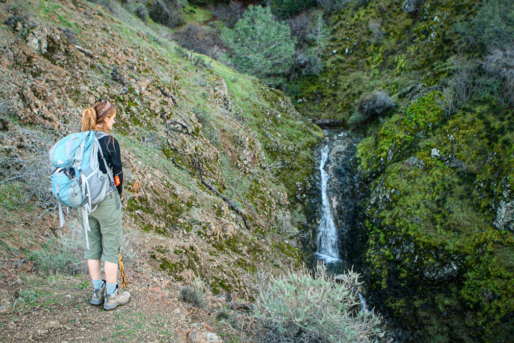
With its looming peak and devilish name, it’s hard to imagine Mount Diablo having a softer side. But winter’s rains bring an unexpected boon: four watery cascades spill off the mountain’s northern flank. And getting to them is half the fun. Start the 5-mile (round-trip) hike with a gentle climb up Donner Canyon Road, passing an old cabin site and large oak trees.

Follow the rushing creek before ascending an open slope that offers uninterrupted views of the Irish-green canyons and hills leading to Mount Diablo’s summit. Then take Middle Earth Trail, a narrow path that ducks through manzanitas, until it links up with the Falls Trail, which skirts the side of the mountain. Parts of this path seem better suited to goats, so take your time and watch your step, especially with recent rains. The upward climb rewards with increasingly better perspectives on the falls. Take a break on a grassy knoll and enjoy huge views of the northern valley.

TIP: These falls usually dry up by late spring and are best after a steady rainfall, but be mindful that the trails are likely to be muddy and slippery right now; proper footwear is essential and so is a change of socks!

{DECEMBER 2023 NOTE: Due to recent storm activity, check the trail status and conditions before going.} Park at the trailhead at the end of Regency Dr. in Clayton (map). Hike the Donner Canyon Fire Road south. After about 1 mile, you’ll come to the Meridian Ridge and Cardinet Oaks Fire Road junction; turn right onto Meridian Ridge. After a few hundred feet, turn left onto the Middle Trail, which climbs up and connects to the Falls Trail. Continue on the Falls Trail, which ends at Cardinet Oaks. Turn left and take this back to the Donner Canyon Fire Road. Donner Canyon Road can be muddy after rains; wear appropriate shoes. No dogs.

Trending Stories NorCal

View all Stories
  1. Hiker in the forest at Mount Sutro in San Francisco

    San Francisco's Middle Earth

    No need to travel to New Zealand to visit Middle Earth. San Francisco’s Mount Sutro Open Space is practically Hobbiton—a hidden “shire” in the middle of the city. Okay, maybe not quite as magical, but still an incredible place to take a hike in city limits.

    View
  2. Bear Hug

    This 5.5-mile loop through Coyote Lake-Harvey Bear Ranch County Park explores one of the newest segments of the acclaimed Bay Area Ridge Trail, one redolent with trees ranging from madrone and manzanita to buckeye and blue elderberry (with a bubbly post-hike bonus).

    View
  3. Bikers and walkers on the Bay Area Ridge Trail with the Golden Gate Bridge behind them

    National Park City Walk

    See San Francisco the way locals do by hiking the Presidio, a national park right in the city! Wooded trails, secluded beaches, and epic views of the Golden Gate Bridge feature on this 5.5-mile out-and-back on the Bay Area Ridge Trail. It’s a lovely slice of the City by the Bay.

    View
  4. Hike top Angel Island Mount Livermore San Francisco Bay

    Good Heavens

    The 4-mile hike to the top of Angel Island offers Bay-mazing scenery. Some people claim you get a five-bridge view: Richmond-San Rafael, Bay, Golden Gate, San Mateo-Hayward, and Dumbarton bridges.

    View

Trending Stories SoCal

View all Stories
  1. Sponsored

    Tram to Cool Treks

    Elevate your fun, getting whisked from palm trees to alpine wilderness on the world’s largest rotating tramcar. The Palm Springs Aerial Tramway transports you up and away on a 2.5-mile scenic route from the desert floor to the refreshing wilderness of Mount San Jacinto State Park.

    View
  2. Coming Up Roses

    Looking to spice up your hiking life? Give your partner a rose—Mount Rose! The 10-mile out-and-back peak hike goes up to one of the grandest views in all of Lake Tahoe. Get ready f

    View
  3. A group of people clamored around the summit marker at Mission Peak in the Bay Area

    Your Mission Is Less Crowded

    Mission Peak is one of the Bay Area’s most popular mountains, with many hikers climbing every weekend. Skip the crowds with this 6-mile loop up the less-traveled southern route.

    View
  4. Woman hiking down the stairs to Coast Royale Beach in Orange County

    Secluded Royale

    Panoramic coastal views and a killer leg workout combine on this 2.7-mile (round-trip) out-and-back hike to secluded Coast Royale Beach in Orange County

    View