Up Umunhum

Hike to the Summit of Mount Umunhum in the South Bay
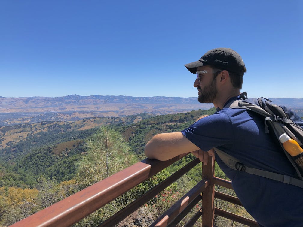
Hiker taking in the mountain view from the summit of Mount Umunhum

Rising from the Santa Cruz Mountains, Mount Umunhum is one of the Bay Area’s highest points, reaching an impressive 3,486 feet. For decades, this mountain was closed to the public, but with the new 7.4-mile (round-trip) addition to the Bay Area Ridge Trail, locals can finally step up to its peak.

Plaque for summit of Mount Umunhum at the summit

A person sitting in front of The Cube radar tower

Sunrise view of the Santa Cruz mountains from Mount Umunhum

Early birds are in for a treat, as sunrise over Bald Mountain (a quick half-mile hike away) can be a breathtaking kaleidoscope of color. Signs for the Bay Area Ridge Trail lead you up a gradual ascent, with much of the route shaded by trees, including groves of red-barked manzanita. Midway up the trail, a marker notes the ruins of an old cabin where the mysterious “Lady of the Mountain” lived in the early 1900s.

Hiker crossing a bridge on the Bay Area Ridge Trail at Mount Umunhum

Hiker taking a photo of flowers along a trail at Mount Umunhum

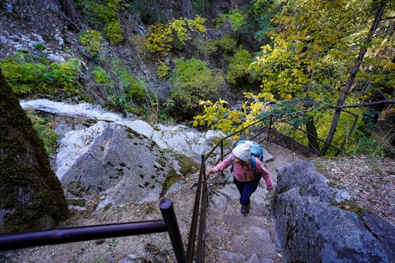
Hiker on the trail hiking up to the summit of Mount Umunhum in the South Bay

As the tree cover begins to thin, the trail intersects with the upper parking lot. From here, the final push to the peak is over slightly steep, rocky terrain; one final challenge before earning your summit. {NOTE: Currently, construction on the upper mountain has closed this section of trail, so hikers should use the stairs by the restrooms. There is no ADA access above this point through 2021.}

Hiker under a canopy of trees on the trail up to the summit of Mount Umunhum

Once atop the summit, take in that view! From the lookout platforms, there’s a gorgeous panorama in every direction, with visibility from the Pacific Ocean all the way to the Sierra. Visitors can also get an up-close view of “The Cube,” the massive radar tower that has become an iconic landmark on the Silicon Valley skyline.

Two hikers heading up the Bay Area Ridge on the way up to the summit of Mount Umunhum

The final stop is the Ceremonial Circle, a reminder of the mountain’s history as a sacred place for local Native American tribes, and a site for ceremony, prayer, and education. Standing among all this beauty, it’s easy to see why Umunhum has been cherished for millennia.

Three hikers smiling at the camera in front of the Bay Area Ridge Trail

Hiker at the summit of Mount Umunhum in the South Bay

HIker at the Ceremonial Circle at the summit of Mount Umunhum in the Santa Cruz Mountains South Bay

BONUS: Early birds or late-day finishers may want to add the 1-mile (round-trip) hike from the parking lot to Bald Mountain, which starts from the same area. Sunrise here is particularly spectacular.

Hiker smiling at the platform summit of Mount Umunhum in the South Bay Santa Cruz Mountains

To reach the trailhead, take Hicks Rd. to Mount Umunhum Rd. in the Sierra Azul Open Space Preserve. Two miles down Mount Umunhum Rd., turn left into the Bald Mountain parking lot. The trail begins across the street. There's no water here, bring your own. No dogs.

Story and photos by Poe Casavant

Trending Stories NorCal

View all Stories
  1. Man hiking up a trail at Montara Mountain, with a view of the Pacific and Grey Whale sand beach in the background

    From Beach to Summit

    No need to decide between a beach and a mountaintop—this hike includes both! Explore the stunning coastal scenery on this 6-mile out-and-back up Montara Mountain and into Rancho Corral de Tierra.

    View
  2. Picnic and a Pedal

    West Marin has all the right stuff for an afternoon getaway: bike paths, babbling brooks, canopy forests, and secluded picnic spots. Combine a picnic and a pedal at Samuel P. Taylor State Park by biking the easygoing Cross Marin Trail.

    View
  3. Most Peaceful Hike of All

    Is this the most peaceful one-hour hike in the Bay Area? It's got our vote! Lake Lagunitas is the smallest lake in a series of five found on the north side of Mount Tam, so it’s got that tiny but mighty charm. Do a 1.5-mile loop around the lake's shore-hugging trail.

    View
  4. Sebastopol Food & Wine Roll

    One apple farm, three charming towns, multiple wineries, and infinite natural beauty. Savor a perfect autumn day in Sonoma County by biking the West County Regional Trail from Sebastopol to Forestville via Graton. It’s a 17-mile (round-trip) adventure. 

    View

Trending Stories SoCal

View all Stories
  1. Woman walking in the Venice Canals of Los Angeles County

    Canal Contemplations

    With its incense-scented boardwalk, bohemian shops, skateparks, and abundance of body builders, Venice is happily eccentric, and artistic. Exhibit A: Its network of European-style canals with charming bridges, offering a tranquil tour of the town’s history.

    View
  2. Wine Down, Dine Out in Lake Chelan

    The fertile soil around Washington State's Lake Chelan is ripe for more than just the amazing apples. Vineyards here yield high quality grapes, and some of the country’s best less-discovered wineries. Locals know it, and you will too when you start choosing from the more than 30 wineries in the region.

    View
  3. What's Up, Winthrop!

    It’s not just its location close to Washington State’s spectacular and less visited national park (North Cascades) that makes Winthrop such a winsome mountain town. This lively enclave in the Methow Valley bristles with a whimsical blend of Wild West charms, contemporary culture, and a mosaic of outdoor adventures—from river to lake to waterfalls, and beyond.

    View
  4. Hike San Diego Volcan Mountain Wilderness

    Planet of the Oaks

    Let us count the number of oak tree species in the Volcan Mountain Wilderness Preserve near Julian: coast, scrub, canyon, black, and Engelmann. Five! The preserve’s Five Oaks Trail is a 3.2-mile hike that boasts all five.

    View