Sitton Pretty

Hike to Sitton Peak in the Santa Ana Mountains

Hike Sitton Peak Santa Ana mountains

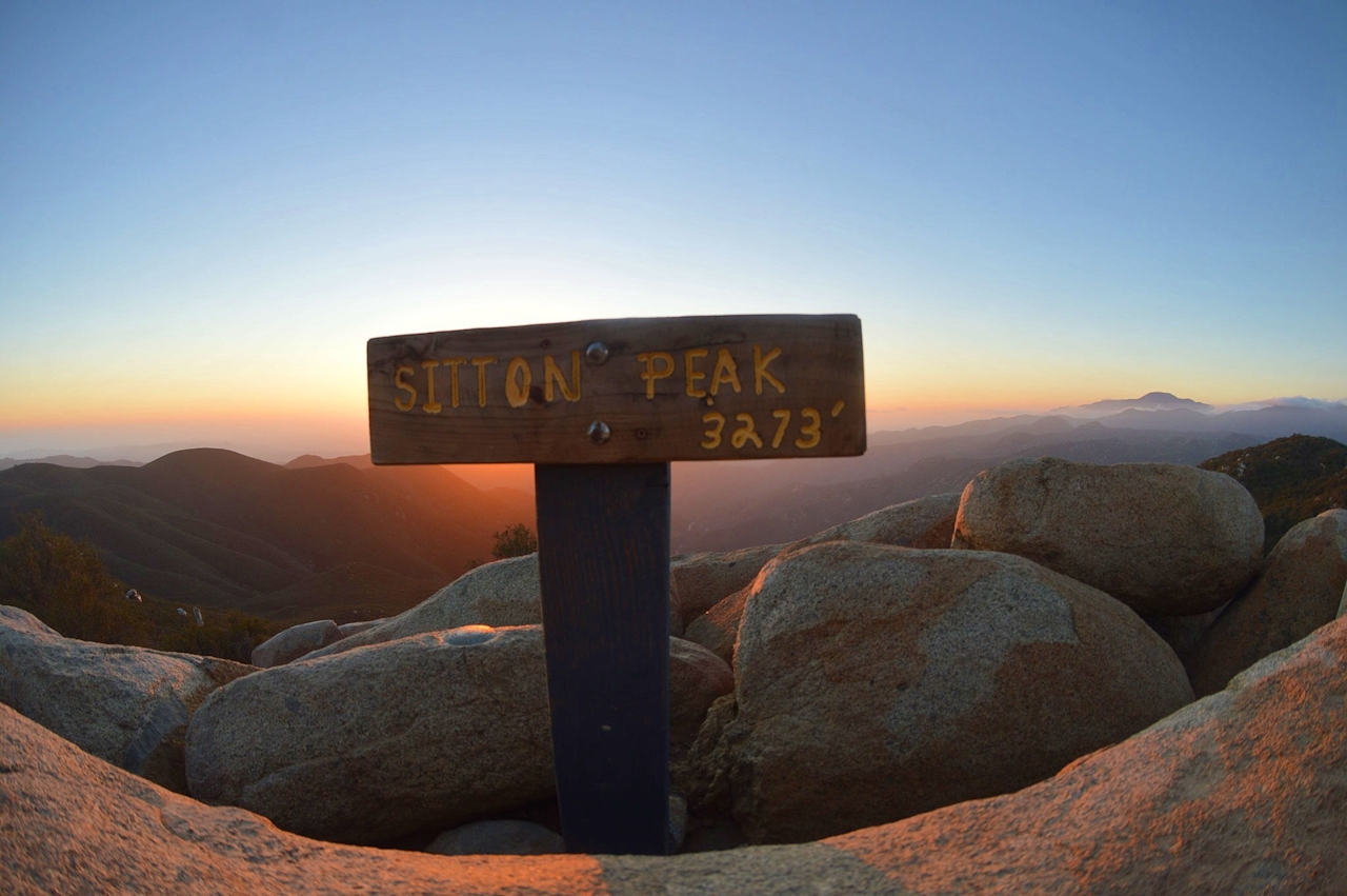
Sitton Peak is a 3,273-foot summit in the Santa Ana Mountains. All in, a 10-mile (round-trip) hike gets you to a panoramic summit filled with hills galloping toward the Pacific. Start up Bear Canyon Trail from Ortega Highway, just across from San Juan Loop Trail. Views broaden over boulder-strewn ridges and the wide canyon as you hike south at a moderate incline before the final, somewhat punishing 0.33-mile push to the peak.
Sitton Peak Santa Ana Mountains

Grab a seat on one of the boulder outcroppings above the chaparral. As one of the highest summits on the south side of Ortega Highway, Sitton offers towering views of Riverside and Orange counties with an expanding vista across countless green peaks. On clear winter days Catalina Island is visible to the west.

Take I-5 to exit 82 in San Juan Capistrano and drive east on Ortega Hwy. (CA-74) for 19.4 miles to the trailhead parking area on the left for San Juan Loop Trail across from Ortega Oaks Candy Store (34040 Ortega Hwy., Lake Elsinore). Cross to the south side of the highway and begin up Bear Canyon Trail. After 1 mile, turn right to stay on Bear Canyon Trail. After another mile, you can stay right on Bear Canyon Trail or turn left up Bear Ridge Trail, a more scenic but slightly longer alternate route (1.5 miles vs. 1.2 miles) to the next junction called Four Corners (where five trails actually meet). Turn right and hike 1.6 miles to a turnoff for Sitton Peak, which comes in a saddle after a half-mile descent. Turn right up the single track to the summit. All junctions are well-marked. Adventure pass required and can be purchased at the candy store. Bottom photo by @thetacoslayers Dog-friendly!

Trending Stories NorCal

View all Stories
  1. Walk on the Wise Side

    A wise man once said, “Walk it off.” And San Francisco has just the place for a colorful walk via a 2.7-mile loop along Philosopher’s Way Trail in the 318-acre John McLaren Park (S

    View
  2. Hiker on the SCA trail in Marin Headlands with view of the Golden Gate Bridge

    Headlands Over Heels

    People come from all over the world to get a glimpse of the Golden Gate Bridge. Get a dramatic and novel view of the bridge without all the people on this moderate 6-mile hike in the Marin Headlands.

    View
  3. woman hiking Mt Tam east peak
    Sponsored

    Marquee Marin

    There may be no better place to find the best in coastal outdoors than the Marin Headlands. Bluff-side hiking trails, beautiful sandy beaches, big Pacific views, an iconic lighthouse, and unique lore in the area’s historic batteries are all part of the action here.

    View

Trending Stories SoCal

View all Stories
  1. Woman hiking the San Onofre Bluffs Loop Trail to San Onofre State Beach in San Diego County

    Bluffing Good!

    Lovely coastline, beautiful beaches, unique geological history, and picturesque sandstone cliffs with limited foot traffic in San Diego County? Head to San Onofre State Beach and the 5-mile San Onofre Bluffs Loop Trail.

    View
  2. Can We Get a Whoop Whoop!

    City, mountain, and ocean views all in one hike? Whoop whoop! It’s no surprise the the Kenter Fire Road and Whoop-de-Doos Trail (a combo of fire road and singletrack) is a favorite among local mountain bikers and hikers alike.

    View
  3. The Big Chill

    In LA, finding a place to chill can be the ultimate flex. So flex, in Franklin Canyon! This unexpected oasis has plenty of shade, cool lake breezes, and ample picnicking spots. Enjoy it on an easy-going 1-mile stroll along its reservoir and duck pond.

    View





