Twice As Nice

Hike to Hidden Twin Peaks in Poway

Woman standing at a peak at Twin Peaks in Poway San Diego

The (arguably) best hidden peak in San Diego is actually two peaks. Twin Peaks in Poway sit at 1,309 and 1,251 feet, respectively. Bag both on a 2-mile lollipop loop that rewards in two ways (of course): classic views and solitude.

Park at Silverset Park with its large grassy lawn, playground, baseball field, and a public restroom. The signed trailhead is at the western entrance, and the trail rises 750 feet in about a mile, getting right into the ascent, passing two benches early in the climb! At the first junction, take a left, and at the second, take a right (you’ll notice two arrows here—the left path is reserved for your descending return). Ignore two spur trails. When in doubt, stick to the path that climbs quickest and heads toward the two jutting peaks directly in front of you.

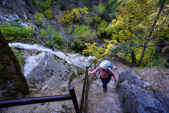
Woman on hiking trail to Twin Peaks in Poway San Diego County

The higher you go, the better the southern views become. After 1 mile, and a challenging final switchback climb, you’re at the first summit (the westernmost twin). Welcome to a picturesque Poway panorama. Mount Woodson and the Lake Poway dam are seen to the east, and to the west you’ll see the prominent peak of Black Mountain. The rolling hills surrounding you are also striking, with hefty boulders dominating the terrain. You’re likely to have the spot to yourself, but if not, you can probably find seclusion at the eastern twin peak via a narrow, slightly overgrown trail that straddles the ridge and gets you to the sibling summit.

When you’re ready to head down, take the rightmost path and follow arrows for Silverset. There are lots of use trails on this return route, but the park (and your car) almost always stay in sight, so continue heading southwest for the most efficient path. This reconnects with the main trail at one of the benches, a good place to rest the knees after the steep descent. Two peaks for one great hike.

BONUS: Take a quick 5-minute drive to Old Poway Park to learn a little more about “the city in the country.” Home to a heritage museum, vintage railroad, and a farmer’s market, this beautiful and historical green space is a great local photo spot. It also happens to be adjacent to some top-notch food and drink, including Smokin’ J’s BBQ, where the perfect post-peak feast awaits.

To get to Silverset Park and the Twin Peaks trailhead, take the I-15 to the Camino Del Norte exit and head east. After 1.7 miles, the street becomes Twin Peaks Rd. and after another 0.7 mile, turn left onto Silverset St. You reach the park, lot, and trailhead after 2 blocks. Dog-friendly!

Trending Stories NorCal

View all Stories
  1. Bear Hug

    This 5.5-mile loop through Coyote Lake-Harvey Bear Ranch County Park explores one of the newest segments of the acclaimed Bay Area Ridge Trail, one redolent with trees ranging from madrone and manzanita to buckeye and blue elderberry (with a bubbly post-hike bonus).

    View
  2. Field of Light at Sensorio in Paso Robles

    Light This Way

    Hidden in the bucolic hills of Paso Robles lies one of the greatest light shows on earth. The lighted art exhibition, Sensorio, is as if the rainbow magic of the aurora borealis was plucked from the sky and planted in the fields.

    View
  3. Bikers and walkers on the Bay Area Ridge Trail with the Golden Gate Bridge behind them

    National Park City Walk

    See San Francisco the way locals do by hiking the Presidio, a national park right in the city! Wooded trails, secluded beaches, and epic views of the Golden Gate Bridge feature on this 5.5-mile out-and-back on the Bay Area Ridge Trail. It’s a lovely slice of the City by the Bay.

    View
  4. Hike top Angel Island Mount Livermore San Francisco Bay

    Good Heavens

    The 4-mile hike to the top of Angel Island offers Bay-mazing scenery. Some people claim you get a five-bridge view: Richmond-San Rafael, Bay, Golden Gate, San Mateo-Hayward, and Dumbarton bridges.

    View

Trending Stories SoCal

View all Stories
  1. Sponsored

    Tram to Cool Treks

    Elevate your fun, getting whisked from palm trees to alpine wilderness on the world’s largest rotating tramcar. The Palm Springs Aerial Tramway transports you up and away on a 2.5-mile scenic route from the desert floor to the refreshing wilderness of Mount San Jacinto State Park.

    View
  2. Coming Up Roses

    Looking to spice up your hiking life? Give your partner a rose—Mount Rose! The 10-mile out-and-back peak hike goes up to one of the grandest views in all of Lake Tahoe. Get ready f

    View
  3. A group of people clamored around the summit marker at Mission Peak in the Bay Area

    Your Mission Is Less Crowded

    Mission Peak is one of the Bay Area’s most popular mountains, with many hikers climbing every weekend. Skip the crowds with this 6-mile loop up the less-traveled southern route.

    View
  4. Bucks Up!

    Come on in, the water is beautiful. Whether you like swimming, kayaking, stand-up paddling, or heading out on a bigger boat, Bucks Lake is a high mountain haven that’s easy to access, blissfully uncrowded, and surrounded by sandy beaches, picnic areas, pines, and aspens.

    View