Hood's New Trail

Hike the new Lawson Trail to a picnic spot at Hood Mountain Regional Park in Sonoma Valley
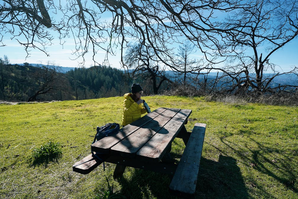
Woman sitting at picnic table at Lawson Picnic spot in Hood Mountain Regional Park Sonoma Valley

Tucked just on the edge of Sonoma Valley near Santa Rosa, Hood Mountain Regional Park and Open Space Preserve is 2,000 acres of wild land and home to the highest summit in the Mayacamas. It’s also got a trail leading up to a brilliant picnic spot with a panorama of Sonoma Valley all the way out to the ocean on clear days.

Woman hiking amid trees at Hood Mountain Regional Park and Open Space Preserve

Woman hiking past signpost indicating the Lawson Trail in Hood Mountain Regional Park in Sonoma Valley

Woman hiking a ridge section of the Lawson Trail in Sonoma Valley Hood Mountain Regional Park and Open Space Preserve

Thank the “Lawson Expansion” initiative, which preserved nearly 250 acres on Mount Hood’s western flank. This 5.5-mile (round-trip) hike includes the new 2-mile section of the Lawson Trail, which leads up to an oak-dotted plateau with a lone picnic table overlooking the sweeping scenery. Start from the parking area and follow the multi-use paved road to the Lower Johnson Ridge Trail, which meanders by a small canyon creek and under a forest before connecting back to the paved road. Follow signs for Merganser Pond and Lower Johnson Ridge Trail before reaching a meadow with a Sonoma County Regional Parks sign pointing the way to the Lawson Picnic Area (2.0 miles).

Woman hiking the Lawson Trail overlooking the Mayacamas mountain range in Hood Mountain Regional Park Sonoma Valley

This is the start of the new Lawson Trail, which you’ll follow in moderate switchbacks among grassland, rocky outcroppings, oak trees, cypress, chaparral, and mega views out to the Sonoma Coast as you reach a ridge leading to the Lawson Picnic Area. Spin around and take in the vast wildland of this precious park surrounding you.

Woman taking a photo of the mountain to sea scenery atop the Lawson Picnic area at Hood Mountain Regional Park in Sonoma County

Sure, there’s just one picnic table, lovingly surrounded by what looks to be artfully planted flower patches along with ancient walnut trees, but this Lawson addition has plenty of room for those willing to sit on their backpacks, blankets, or whatever else suits your hike-in picnic style. Stay awhile … it’s nice up here!

daisy flowers set at the top of Lawson Picnic area at Hood Mountain in Sonoma Valley

To reach the trailhead for this hike, use the Hood Mountain Pythian Road entrance off Hwy. 12, across from Oakmont (map). Park in the upper lot at the road’s end ($7 fee, or free with a Sonoma County Parks pass) and follow the paved road to the Lower Johnson Ridge Trail and follow signs for the Lower Johnson Ridge Trail until the sign pointing the route to the Lawson Picnic Area. NOTE: Water is not available at the park; plan accordingly. This trail is popular with courteous mountain bikers too. Please share the trail. Bring a map. Dog-friendly!

Trending Stories NorCal

View all Stories
  1. Hiker in the forest at Mount Sutro in San Francisco

    San Francisco's Middle Earth

    No need to travel to New Zealand to visit Middle Earth. San Francisco’s Mount Sutro Open Space is practically Hobbiton—a hidden “shire” in the middle of the city. Okay, maybe not quite as magical, but still an incredible place to take a hike in city limits.

    View
  2. Bikers and walkers on the Bay Area Ridge Trail with the Golden Gate Bridge behind them

    National Park City Walk

    See San Francisco the way locals do by hiking the Presidio, a national park right in the city! Wooded trails, secluded beaches, and epic views of the Golden Gate Bridge feature on this 5.5-mile out-and-back on the Bay Area Ridge Trail. It’s a lovely slice of the City by the Bay.

    View
  3. A group of people clamored around the summit marker at Mission Peak in the Bay Area

    Your Mission Is Less Crowded

    Mission Peak is one of the Bay Area’s most popular mountains, with many hikers climbing every weekend. Skip the crowds with this 6-mile loop up the less-traveled southern route.

    View
  4. Hike top Angel Island Mount Livermore San Francisco Bay

    Good Heavens

    The 4-mile hike to the top of Angel Island offers Bay-mazing scenery. Some people claim you get a five-bridge view: Richmond-San Rafael, Bay, Golden Gate, San Mateo-Hayward, and Dumbarton bridges.

    View

Trending Stories SoCal

View all Stories
  1. Bear Hug

    This 5.5-mile loop through Coyote Lake-Harvey Bear Ranch County Park explores one of the newest segments of the acclaimed Bay Area Ridge Trail, one redolent with trees ranging from madrone and manzanita to buckeye and blue elderberry (with a bubbly post-hike bonus).

    View
  2. Sponsored

    Tram to Cool Treks

    Elevate your fun, getting whisked from palm trees to alpine wilderness on the world’s largest rotating tramcar. The Palm Springs Aerial Tramway transports you up and away on a 2.5-mile scenic route from the desert floor to the refreshing wilderness of Mount San Jacinto State Park.

    View
  3. Coming Up Roses

    Looking to spice up your hiking life? Give your partner a rose—Mount Rose! The 10-mile out-and-back peak hike goes up to one of the grandest views in all of Lake Tahoe. Get ready f

    View
  4. Woman hiking down the stairs to Coast Royale Beach in Orange County

    Secluded Royale

    Panoramic coastal views and a killer leg workout combine on this 2.7-mile (round-trip) out-and-back hike to secluded Coast Royale Beach in Orange County

    View