Simi's Secret Loop
Hike the hidden Woodridge Loop Trail at Long Canyon in Simi Valley

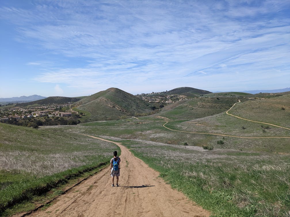
The secluded 2.8-mile Woodridge Loop at Long Canyon in Simi Valley rewards with rolling hills, grassy meadows, unique rock formations, and some of the most magical valley views in Ventura County.


Park at the spacious lot and take the trailhead at the southeast end of the lot under a eucalyptus tree; the path immediately climbs and doesn’t let up until about the half-mile mark. The upside, aside from the ascent, is the incredible views into lush canyon and the surrounding valley all the way to the Santa Susana Mountains in the northeast. The rolling green hills of Long Canyon and neighboring Woodridge Open Space are awesome as well—Simi Peak is the tallest nearby peak at 2400 feet, to the southeast.

Ignore the first junction and grab a rest at a well-placed bench that also has complimentary bike bells (yes, you may be sharing the trail!). At the second junction make a sharp right, descending parallel into the canyon. If you seek more mileage, the southeastern trail here heads further into Woodridge Open Space (just make sure to grab a map at the trailhead). Otherwise, continue west between healthy hills that scream Scottish Highlands (without the sheep). In spring, look for the purple flowers of blue dicks and the white blooms of radishes flanking the peaceful path (and some striking lone arboreal residents too!).


This is the Autumn Ridge Trail. Stay on it until you reach a pond and three-way junction. Here, take the Woodridge Loop Trail that scales the hill, passing a fire road giving northern views and descending behind a quaint residential area. Look for small orange blankets of California poppy and blue-purple bushels of lupines, a welcome secret treasure during spring. The trail eventually passes some interesting geological formations and cacti before connecting back to the parking lot.

To get to the Woodridge Loop at Long Canyon, take the CA-118 to the First St. exit and head south. After 2.9 miles, this becomes Long Canyon Rd. Continue for another 1.7 miles before finding the parking lot at the intersection with Bannister Way. See a map for this route by clicking on the Lang Ranch/Woodridge icon on this info page. Dog-friendly!
Story and photos by Matt Pawlik, @mattitudehikes


