Hello, Sunol

Hike Sunol Regional Park for Wildflowers

{NOTE: APRIL 19, 2023: Because of this park's popularity, there may be temporary closures due to capacity limitations. Access points and parking areas may close temporarily and re-open when capacity is available. }

It's one of the grandest hikes of them all: Sunol Regional Park positively beams in spring. Take the grand tour and see major landmarks in the park on a 6-mile (round-trip) hike featuring babbling brooks, beautiful peaks, and burgeoning wildflowers. There’s some solid climbing on this route to get to the views … but the vista you get is worth the effort. Start from the Sunol Wilderness Regional Preserve headquarters. Cross Alameda Creek via the bridge to the Canyon View Trail on the right. Walking through the small valley, you’ll feel whisked along by the sounds of the creek just a few feet away. Take your second left onto the Indian Joe Creek Trail, which is the beginning of your ascent. The trail quickly leads you to Indian Joe Creek. As you climb, the trail meanders its way along the creek and includes a handful of stream crossings.

Person taking a hiking break sitting on a bench overlooking scenery at Sunol Wilderness Regional Preserve

Hiker on trail at Sunol Wilderness Regional Preserve

purple wildflowers alongside a hiking trail at Sunol Wilderness Regional Preserve

Hiker on bridge at Sunol Wilderness Regional Preserve

Hiker along a trail at Sunol Regional Wilderness Preserve

As you climb, pass though oak savanna that is dotted with California poppies in spring. After nearly 1.5 miles of ascending, you'll reach a T-intersection. Follow Cave Rocks Road to the right. The trail also offers panoramic views of the neighboring hillsides and the Calaveras Reservoir a few miles to the south. The top of your climb marks another highlight of the trip, marked by the large rock Cerro Este Overlook sign and a bench. Take a breather, grab a snack, and soak in the view. On clear days, you can see the Bay. Head down the mountain on Cerro Este Road.

Poppies at Sunol Wilderness Regional Preserve

As you get closer to the valley floor, follow the signs to Little Yosemite, where Alameda Creek and the canyon feature an oases that's either relatively calm or, after heavy rains, quite lively! Scramble down a few rocks to the water’s edge. Hop a bit more and explore the area on the giant boulders that give Little Yosemite its grandness.

Little Yosemite in Sunol Wilderness Regional Preserve

Get back to the parking lot by backtracking slightly up Cerro Este Road to Canyon View Trail (about 0.2 mile). Take a left and follow the trail for the final 1.5 miles.

This is great for a cooler day or a morning hike. The hike is difficult, with over 1500 feet of elevation gain that is mostly completed in the first half of the hike. Be sure to bring plenty of water and snacks for the trail. A park access fee of $5 is required when the attendant is on duty. The park has poor cell service, so grab a trail map or snap a picture of the map that is posted before crossing the Alameda Creek bridge. You can also download the trail map. Dog-friendly!

Trending Stories NorCal

View all Stories
  1. All right, Almaden!

    Take a trip through time on this 5-mile loop in Almaden Quicksilver County Park. Explore the ruins of an old cinnabar mine and enjoy the first hints of wildflower season.

    View
  2. Waterfalls and Wine Pours

    Cooler temps, green hills, and the return of our magnificent waterfalls! This family-friendly 2-mile hike at Uvas Canyon County Park in Morgan Hill is a great way to get the most out of a short hike post-rain.

    View
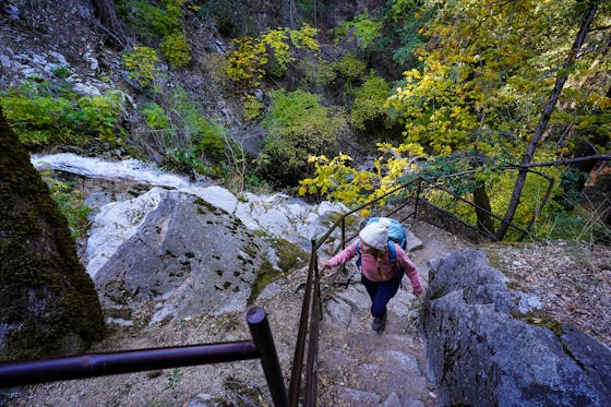
  3. Woman hiker is climbing up the ladder in the Steep Ravine section of the Dipsea Loop Trail on Mount Tam

    Misty on Mount Tam

    Mount Tam’s 3.9-mile round-trip Steep Ravine and Dipsea Trail Loop weathers the wets and wilds with some confidence, sheltered in parts by redwoods, and wowing with a waterfall.

    View
  4. Mile-Long Cataract Club

    In winter after heavy rains, the north flank of Mount Tam glows with flows. The nearly mile-long series of waterfalls—Cataract Falls—transforms into a supercharged spectacle. Starting at Alpine Dam, a 1.6 mile (one-way) narrow trails threads through redwoods and ferns along Cataract Creek.

    View

Trending Stories SoCal

View all Stories
  1. Peace Labyrinth

    Hidden in LA’s historic West Adams district, the Peace Awareness Labyrinth & Gardens is a welcome respite from the norms of urban noise.

    View
  2. Weekend Sherpa Podcast: Take It Outside

    Adventure for your earbuds. What's new in the world of the outdoors? Listen to Weekend Sherpa co-founders discuss local hikes, beaches, bike rides, camping spots and all kinds of travel and adventure in California and beyond!

    View
  3. Hikers sitting on a large rock slab next to Three Sisters Falls in Cleveland National Forest Southern California near Julian

    Three Sisters

    Good things come in threes at this hike to a lovely trio-tiered waterfall in Cleveland National Forest. The 4.25-mile out-and-back hike rambles among rolling hills, with rocky mountain views as switchbacks take you down to a lush canyon and the falls.

    View
  4. People gathered around a tree at an LA Park as part of the Tree Tour led by Stephanie Carrie

    LA's Tree Tour

    Los Angeles is famous for its iconic palm trees but did you know that LA is home to one of the most diverse urban forests in the world? With over 1,000 different tree species lining its streets, LA offers a unique urban canopy waiting to be explored. One of the best ways to discover it is by joining a Tree Tour

    View