Merry in Moreno Valley

Hike Cold Creek Trail in Moreno Valley
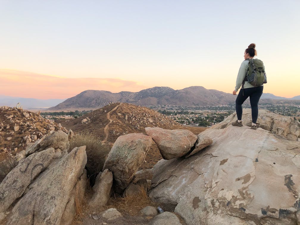
At 2.6 miles round trip, a quick escape to the out-and-back Cold Creek Trail in Moreno Valley is a great way to enjoy a beautiful sunset. The trailhead is located right in the middle of the city (or more accurately, a suburban neighborhood) and is very easy to access.

As you depart from the trailhead, it isn’t long before you leave the neighborhood behind. The trail starts out rather flat as it skirts the back side of houses, but soon you’ll be on a gradual climb (226 feet elevation) into the hills.

Once above the houses, the views open up into a sweeping panorama of the Inland Empire, San Bernardino Mountains, and San Jacinto Mountains (including two of southern California’s tallest peaks: San Gorgonio and San Jacinto).

The trail is wide open and easy to follow for almost the entire length. Just before reaching the end, the trail veers sharply uphill and becomes much narrower—but don’t worry, this part only lasts for a minute or two until you reach a flat area with some really cool rocks. This is the end of the trail.

After snapping a few photos of the view, head back the way you came, enjoying the setting sun for the rest of your hike. For the best sunset experience, aim to start your hike around 45 minutes before the official sunset time, depending on how fast you like to hike.

The Cold Creek Trail is located in Moreno Valley. Map. Park is open from 7 a.m. to 10 p.m. Street parking available in the neighborhood but please be respectful of the locals. Dog-friendly.

Story and photos by Natalie Bates, @wanderwithnatalie

Trending Stories NorCal

View all Stories
  1. Hiker in the forest at Mount Sutro in San Francisco

    San Francisco's Middle Earth

    No need to travel to New Zealand to visit Middle Earth. San Francisco’s Mount Sutro Open Space is practically Hobbiton—a hidden “shire” in the middle of the city. Okay, maybe not quite as magical, but still an incredible place to take a hike in city limits.

    View
  2. Bikers and walkers on the Bay Area Ridge Trail with the Golden Gate Bridge behind them

    National Park City Walk

    See San Francisco the way locals do by hiking the Presidio, a national park right in the city! Wooded trails, secluded beaches, and epic views of the Golden Gate Bridge feature on this 5.5-mile out-and-back on the Bay Area Ridge Trail. It’s a lovely slice of the City by the Bay.

    View
  3. A group of people clamored around the summit marker at Mission Peak in the Bay Area

    Your Mission Is Less Crowded

    Mission Peak is one of the Bay Area’s most popular mountains, with many hikers climbing every weekend. Skip the crowds with this 6-mile loop up the less-traveled southern route.

    View
  4. Hike top Angel Island Mount Livermore San Francisco Bay

    Good Heavens

    The 4-mile hike to the top of Angel Island offers Bay-mazing scenery. Some people claim you get a five-bridge view: Richmond-San Rafael, Bay, Golden Gate, San Mateo-Hayward, and Dumbarton bridges.

    View

Trending Stories SoCal

View all Stories
  1. Bear Hug

    This 5.5-mile loop through Coyote Lake-Harvey Bear Ranch County Park explores one of the newest segments of the acclaimed Bay Area Ridge Trail, one redolent with trees ranging from madrone and manzanita to buckeye and blue elderberry (with a bubbly post-hike bonus).

    View
  2. Sponsored

    Tram to Cool Treks

    Elevate your fun, getting whisked from palm trees to alpine wilderness on the world’s largest rotating tramcar. The Palm Springs Aerial Tramway transports you up and away on a 2.5-mile scenic route from the desert floor to the refreshing wilderness of Mount San Jacinto State Park.

    View
  3. Coming Up Roses

    Looking to spice up your hiking life? Give your partner a rose—Mount Rose! The 10-mile out-and-back peak hike goes up to one of the grandest views in all of Lake Tahoe. Get ready f

    View
  4. Woman hiking down the stairs to Coast Royale Beach in Orange County

    Secluded Royale

    Panoramic coastal views and a killer leg workout combine on this 2.7-mile (round-trip) out-and-back hike to secluded Coast Royale Beach in Orange County

    View