Border Field State Park

Hike Border Field State Park in San Diego County
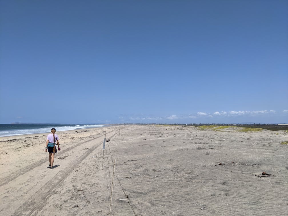
Woman hiking along the vast and open beach at Border Field State Park in Southern California

Border Field State Park, just south of Imperial Beach, is home to the southernmost point in California as well as one of the last beautiful undeveloped coastlines in the state. Visit this natural refuge that neighbors Mexico’s Playas de Tijuana suburb and go on a 4.5-mile hike featuring important history and wildlife habitats. Plus stunning SoCal beach scenery.

Woman hiking a wide and sandy trail at Border Field State Park in San Diego County

Woman hiking past a sign and onto the beach at Border Field State Park in San Diego County

Park at the gated entrance to the park in a dirt lot off Monument Road (free; on weekends, you can also pay $7 to park further west to reduce your hiking mileage). Head west on the dirt road or accompanying singletrack trail, passing the park’s entrance, a trail map, and mosaic art along the fence. The path ventures through the Tijuana River National Estuarine Research Reserve, offering up-close views of riparian vegetation and resident fauna (look for swallowtail butterflies). A spur-trail, if open, provides a short 0.5-mile detour loop on your right for an additional riparian romp (a sign will indicate if it’s available for human foot traffic).

A couple stand on a concreted structure on the beach at Border Field State Park in San Diego County

Birds on the beach at Border Field State Natural Reserve in San Diego County

At just over half a mile you’ll reach a junction; keep right to continue toward the Pacific. The relatively flat salt and freshwater marsh preserve means expansive views to the north. Look for Imperial Beach and beyond to Point Loma. The highlight of this portion is a quaint bridge that crosses the narrow waterway of the Tijuana River. Here is one of many fantastic spots for birders. Look to the marsh for hunting great blue herons or wading green-winged teals, among other waterfowl. Sand dunes also come into view here, as you continue to the expansive sandy shore. You may not see another soul on this massive beach, which is an incredibly rare occurrence in San Diego County. Hop on some concrete ruins for photos.

Head north for 0.7 mile to reach the northernmost point of the park, where the Tijuana River reaches the Pacific. The merging of fresh and saltwater environments is also a great area to look for the threatened Western snowy plover amongst the dunes. Next, head south, passing flocks of gulls, terns, and various shore birds, such as the black-necked stilt and the American avocet. You will soon reach the international border, marked by a fenced wall of pillars stretching into the water.

Woman walking on the beach at Border Field State Park in San Diego County

Here, take the trail up the hill to Friendship Park, home to a border monument, interpretive signs detailing the history and local ecosystem, and plenty of shaded tables for a picnic. At the eastern edge of the park is a road, adjacent to those imposing border walls, that reconnects with the dirt path that takes you back to the park entrance and your car.

To get to the Border Field State Park entrance, take the I-5 to the Tocayo Ave. exit (exit 3). After 0.4 mile, turn left onto Hollister St. and take it south for 1.4 miles to Monument Rd. Head right on Monument Rd. for another 1.4 miles to the park entrance gates and dirt lot. No dogs!

Story and photos by Matt Pawlik

Trending Stories NorCal

View all Stories
  1. Field of Light at Sensorio in Paso Robles

    Light This Way

    Hidden in the bucolic hills of Paso Robles lies one of the greatest light shows on earth. The lighted art exhibition, Sensorio, is as if the rainbow magic of the aurora borealis was plucked from the sky and planted in the fields.

    View
  2. Surfboards and tents for shade are set up on the beach at Cull Canyon Regional Recreation Area in the Swim Lagoon Area

    Switchbacks and Swimming Holes

    Hike hard, play hard! This 7-mile out-and-back in Cull Canyon Regional Recreation Area is a great workout with payoff vistas and a relaxing post-hike picnic and dip in the water.

    View
  3. Hike the Rainbow

    Catch all the colors of a rainbow at Calero County Park on this 10-mile hike currently showcasing the season’s best blooms.

    View
  4. Hike Purisima Creek Open Space Preserve

    Purisima Charisma

    Hundred-foot redwoods, a shaded canyon, and views overlooking Half Moon Bay. This 10-mile loop hike in Purisima Creek Redwoods Open Space Preserve is a roller-coaster of uphill and downhill along with easygoing stretches through some of the Bay Area’s most beautiful landscape.

    View

Trending Stories SoCal

View all Stories
  1. People on a guided horseback tour with Central Coast Trailrides at Santa Margarita Ranch near Paso Robles

    Saddle Up with Central Coast Trailrides

    Untouched and sweeping, the mountainous scenery and deep valleys of Santa Margarita near Paso Robles are just begging to be explored. So saddle up for a scenic adventure with Central Coast Trailrides (CCT) at the 14,000-acre Santa Margarita Ranch.

    View
  2. A woman on a hiking trail with huge open space and yellow flowers around her at Wildwood Park in Thousand Oaks

    Going Wildwood

    Consider this your invitation to get a little untamed. In just one walk through Wildwood Park in Thousand Oaks, you can chase the sound of a cascading waterfall, duck into a shadowy cave, and soak in big hillside vistas. The mostly flat 4.25-mile loop makes wild feel wonderfully accessible.

    View
  3. Two people fly fishing on the Truckee River with guides from Reno Fly Shop

    Zen and the Art of Fly Fishing

    Learning to fly fish is one of the most fun and beautiful ways to connect with nature, family, friends, and yourself. It’s also a great way to truly experience the magic of a place. Make that place Reno Tahoe, where a fly fishing adventure with Reno Fly Shop is like being planted in a plein air painting of dreamy outdoors.

    View
  4. A woman on the overlook deck overlooking the Truckee River at Oxbow Nature Study Area in Reno

    This Way to Oxbow and Dickerson Road

    Just west of downtown Reno—tucked right alongside the Truckee River—is a nature haven for wildlife spotting and waterside relaxing. The 22-acre Oxbow Nature Study Area is ideal for those seeking solitude and a short hike. Afterwards, explore the creative hub of Dickerson Road.

    View