Norco Powered

Do a short and scenic hike to the top of Norco Mountain in Riverside County
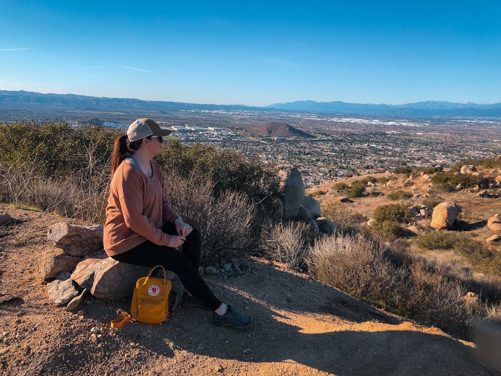
Solitude and a possible sunset viewing can be hard to come by in bustling Southern California. But you can find it at the Norco Mountain via Powerline Road trail. The 2.5-mile out-and-back trail in Norco climbs 643 feet to the summit of Norco Mountain—a small peak overlooking the Inland Empire. True to its name, the trail is almost constantly in the presence of powerlines, but other than that aspect it is a pleasant trail with beautiful views of the surrounding hills and mountains in every direction you look.

The trail begins in a small park at the end of a cul-de-sac. At the back of the park behind the horse corral you’ll see a dirt path, which quickly leads you to Powerline Road (NOTE: Be sure to follow this route to avoid crossing into private property). It’s a steady uphill from the trailhead to the summit but the grade of the trail keeps it from feeling too challenging, likely because it’s an actual road used by the power company; this also means that the trail is wide and very easy to follow. If you take the road until it ends, you’ll reach a fence with a “No Trespassing” sign posted on it. However, a little before the end you’ll see a spur trail on your right.

That spur will allow you to summit the little mountain without going into the restricted area. Once you reach that point there are plenty of places to sit and enjoy the view as the sun dips below the horizon, filling the sky with vibrant hues of pink, orange, and purple. The San Bernardino and San Gabriel Mountains can be seen off in the distance while the lights of the Inland Empire begin to fill the night sky. Make your way back down the same way.

{January 2024 Note: Due to recent rains, be sure to check trail conditions before embarking on this hike.}The Norco Mountain via Powerline Road trail begins behind Ridge Ranch Park in Norco, at the end of a residential cul-de-sac. GPS might send you straight to Powerline Road, which is private property. Look for the park instead and enter the trail on foot via the bypass trail described above to avoid trespassing. Street parking only; be sure to obey all posted parking signs and be respectful of the residents. Location. Bring a headlamp or flashlight if you plan to watch some of the sunset from here. Dog-friendly!

Story and photos by Natalie Bates, @wanderwithnatalie

Trending Stories NorCal

View all Stories
  1. Bear Hug

    This 5.5-mile loop through Coyote Lake-Harvey Bear Ranch County Park explores one of the newest segments of the acclaimed Bay Area Ridge Trail, one redolent with trees ranging from madrone and manzanita to buckeye and blue elderberry (with a bubbly post-hike bonus).

    View
  2. Field of Light at Sensorio in Paso Robles

    Light This Way

    Hidden in the bucolic hills of Paso Robles lies one of the greatest light shows on earth. The lighted art exhibition, Sensorio, is as if the rainbow magic of the aurora borealis was plucked from the sky and planted in the fields.

    View
  3. Bikers and walkers on the Bay Area Ridge Trail with the Golden Gate Bridge behind them

    National Park City Walk

    See San Francisco the way locals do by hiking the Presidio, a national park right in the city! Wooded trails, secluded beaches, and epic views of the Golden Gate Bridge feature on this 5.5-mile out-and-back on the Bay Area Ridge Trail. It’s a lovely slice of the City by the Bay.

    View
  4. Hike top Angel Island Mount Livermore San Francisco Bay

    Good Heavens

    The 4-mile hike to the top of Angel Island offers Bay-mazing scenery. Some people claim you get a five-bridge view: Richmond-San Rafael, Bay, Golden Gate, San Mateo-Hayward, and Dumbarton bridges.

    View

Trending Stories SoCal

View all Stories
  1. Sponsored

    Tram to Cool Treks

    Elevate your fun, getting whisked from palm trees to alpine wilderness on the world’s largest rotating tramcar. The Palm Springs Aerial Tramway transports you up and away on a 2.5-mile scenic route from the desert floor to the refreshing wilderness of Mount San Jacinto State Park.

    View
  2. Coming Up Roses

    Looking to spice up your hiking life? Give your partner a rose—Mount Rose! The 10-mile out-and-back peak hike goes up to one of the grandest views in all of Lake Tahoe. Get ready f

    View
  3. A group of people clamored around the summit marker at Mission Peak in the Bay Area

    Your Mission Is Less Crowded

    Mission Peak is one of the Bay Area’s most popular mountains, with many hikers climbing every weekend. Skip the crowds with this 6-mile loop up the less-traveled southern route.

    View
  4. Bucks Up!

    Come on in, the water is beautiful. Whether you like swimming, kayaking, stand-up paddling, or heading out on a bigger boat, Bucks Lake is a high mountain haven that’s easy to access, blissfully uncrowded, and surrounded by sandy beaches, picnic areas, pines, and aspens.

    View