Marshall Mellow

Wildflower Hike at Marshall Peak in San Bernardino National Forest
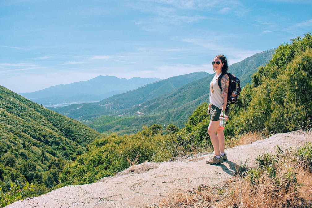
Woman standing and overlooking the scenery at Marshall Peak in San Bernardino National Forest

The 3-mile (round-trip) Marshall Peak Trail might not be the most epic in the San Bernardino National Forest, but this lightly used trail is beautiful in spring when the wildflowers come out. This hike isn’t really so much a trail in fact, but rather a stroll along a dirt road. Cars are able to use this road (and they do), so use caution and listen for the sound of approaching cars, especially around curves (the road is plenty wide enough to allow vehicles and other hikers to pass).

The trail gradually climbs 456 feet in elevation, but the grade is gentle enough to feel like a pleasant nature walk. Vibrant wildflowers like monkeyflower and mountain pennyroyal line the road, and panoramic views of the Inland Empire welcome you at every turn. It is worth noting, however, that there is very little shade on this hike and the air can get very dusty from the cars kicking up dirt—bring lots of water, and do this hike only in spring and when temperatures are cooler. Eventually the trail opens up into a crossroads with paths branching off in every direction.

Looking forward from where the trail spits you out, the peak is around the 1:00-2:00 position. The trail gets considerably steeper at this point, and the road is covered in deep ruts, so if the trail you chose doesn’t fit this description, turn back and try a different one! Thankfully, this stretch of trail is very short, maybe a couple hundred feet at most.

If you were wondering where all the cars that passed you on the road were going, you’ll get your answer when you reach the summit: Marshall Peak is used as a launch site for hang gliders and paragliders! On any weekend day you’ll likely see several of them prepping to launch, or already up in the air. The summit is huge, so it’s easy to find a place out of the way. Sit, relax, enjoy the view, and watch them soar through the sky!

IMPORTANT: Check temperatures before hiking these or any trails. Excessive heat makes hiking very dangerous and both people and their dogs should not be hiking on hot days.

From the CA-210, take the exit for the CA-18/Waterman Ave. and head north for approximately 11 miles (you’ll actually pass the trailhead, but it’s on the opposite side of the road and inaccessible when heading northbound). You’ll see a left-hand turn lane appear (up until this point the highway is single lane and has a barrier down the center)—use that lane to make a u-turn when it is safe to do so. Head back down the CA-18 for approximately 2 miles. You’ll see a wide dirt lot on the right-hand side that has a dirt road leading away from it. Park in the lot and head up the dirt road on foot—this is the trail! Adventure Pass required. Dog-friendly!

Story and photos by Natalie Bates, @thefreeboheme

Trending Stories NorCal

View all Stories
  1. Field of Light at Sensorio in Paso Robles

    Light This Way

    Hidden in the bucolic hills of Paso Robles lies one of the greatest light shows on earth. The lighted art exhibition, Sensorio, is as if the rainbow magic of the aurora borealis was plucked from the sky and planted in the fields.

    View
  2. Surfboards and tents for shade are set up on the beach at Cull Canyon Regional Recreation Area in the Swim Lagoon Area

    Switchbacks and Swimming Holes

    Hike hard, play hard! This 7-mile out-and-back in Cull Canyon Regional Recreation Area is a great workout with payoff vistas and a relaxing post-hike picnic and dip in the water.

    View
  3. Hike the Rainbow

    Catch all the colors of a rainbow at Calero County Park on this 10-mile hike currently showcasing the season’s best blooms.

    View
  4. Hike Purisima Creek Open Space Preserve

    Purisima Charisma

    Hundred-foot redwoods, a shaded canyon, and views overlooking Half Moon Bay. This 10-mile loop hike in Purisima Creek Redwoods Open Space Preserve is a roller-coaster of uphill and downhill along with easygoing stretches through some of the Bay Area’s most beautiful landscape.

    View

Trending Stories SoCal

View all Stories
  1. People on a guided horseback tour with Central Coast Trailrides at Santa Margarita Ranch near Paso Robles

    Saddle Up with Central Coast Trailrides

    Untouched and sweeping, the mountainous scenery and deep valleys of Santa Margarita near Paso Robles are just begging to be explored. So saddle up for a scenic adventure with Central Coast Trailrides (CCT) at the 14,000-acre Santa Margarita Ranch.

    View
  2. A woman on a hiking trail with huge open space and yellow flowers around her at Wildwood Park in Thousand Oaks

    Going Wildwood

    Consider this your invitation to get a little untamed. In just one walk through Wildwood Park in Thousand Oaks, you can chase the sound of a cascading waterfall, duck into a shadowy cave, and soak in big hillside vistas. The mostly flat 4.25-mile loop makes wild feel wonderfully accessible.

    View
  3. Two people fly fishing on the Truckee River with guides from Reno Fly Shop

    Zen and the Art of Fly Fishing

    Learning to fly fish is one of the most fun and beautiful ways to connect with nature, family, friends, and yourself. It’s also a great way to truly experience the magic of a place. Make that place Reno Tahoe, where a fly fishing adventure with Reno Fly Shop is like being planted in a plein air painting of dreamy outdoors.

    View
  4. A woman on the overlook deck overlooking the Truckee River at Oxbow Nature Study Area in Reno

    This Way to Oxbow and Dickerson Road

    Just west of downtown Reno—tucked right alongside the Truckee River—is a nature haven for wildlife spotting and waterside relaxing. The 22-acre Oxbow Nature Study Area is ideal for those seeking solitude and a short hike. Afterwards, explore the creative hub of Dickerson Road.

    View