Hike of Fame
Hike to the Hollywood Sign via Brush Canyon Trail

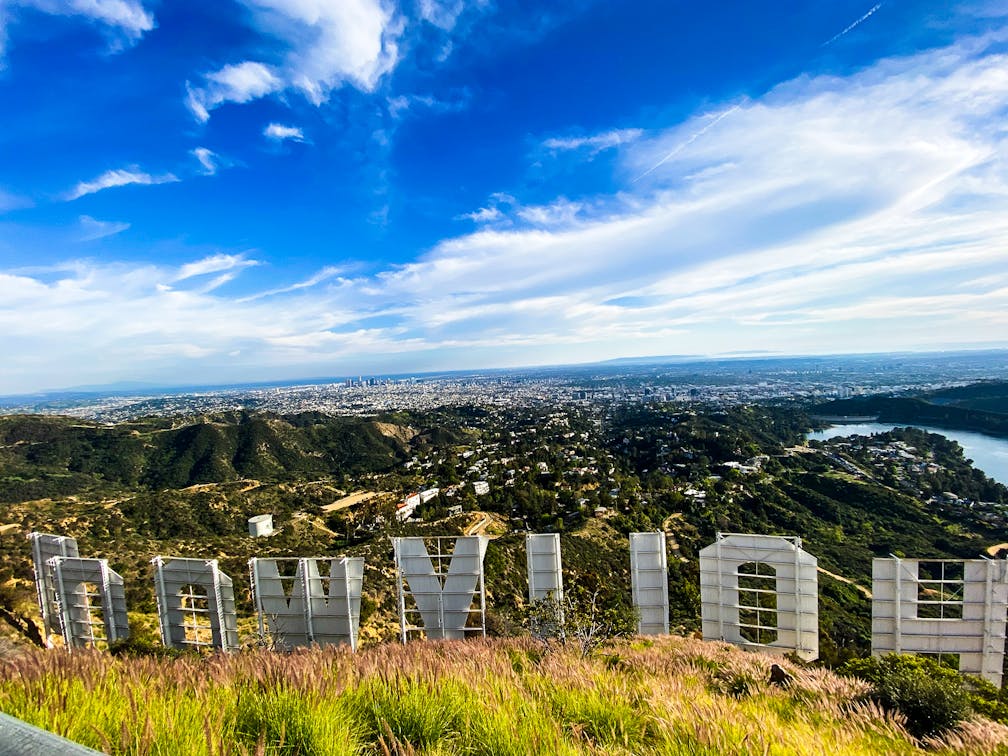
Ready to hike and brush up on some LA lore? All signs point to Brush Canyon Trail and Mount Lee in Griffith Park. The 6-mile out-and-back Brush Canyon Trail to the summit of Mount Lee is a blockbuster with 1,100 feet of elevation gain, glamorous city views, and the closest and most unique perspective of those giant white letters.


Park along the street, in a small paved lot, or a large dirt lot at the terminus of Canyon Drive at the western edge of Griffith Park. Depending on the crowds, you may have to add up to 1 mile (round trip) to your hike along the road (and we recommend adding an extra half-mile detour to visit the nearby Bronson Caves just south of the Brush Canyon trailhead; note: the Bronson Caves are currently fenced off, but you can still admire them from the outside). Otherwise, check the map just past the gate and begin ascending on Brush Canyon Trail, climbing more than 600 feet in just over a mile while passing under giant oaks and sycamores.

The vistas to the south of Hollywood and beyond get better as you continue climbing. At your first junction, take a left onto the Mulholland Trail (to the right will take you to Mount Chapel). Walking along the canyon walls, you may be sharing the trail with a guided horse-tour from the nearby stables. At the junction with Hollyridge Trail, stay right (the horses will head home to the left), continuing on the Mulholland Trail (signs will also consistently guide you). Here you get a great view of neighboring Mount Hollywood and the Griffith Observatory, in addition to the downtown skyline and the Pacific Ocean on clear days.

At the next junction, take a right onto Mount Lee Drive, following signs for the summit. If you head left here, you can get another nice view of the sign from below; but you’re here to get to the top! This paved path gives you a final leg-busting workout and rewards with new, northern views—an epic panorama over Burbank framed by the Santa Susana, Verdugo, and San Gabriel Mountains. Soon you’ll pass a plaque and spur trail for Cahuenga Peak if you seek additional mileage. Otherwise, continue wrapping around the summit along the fence overlooking the famous sign.

You’ll notice love/friendship locks on the fence—and though you’ll be distracted by first glimpses of the sign, continue up to the actual summit (1,708 feet) past the radio towers for the best angle. In addition to a truly special perspective of the iconic sign, you also have your best city views yet, including the particularly welcoming addition of Lake Hollywood, a giant reservoir that has a loop trail with another great angle of the sign, which has been here since 1923. It’s hard to leave this spot, and we recommend hiking near sunset, to get golden skies on your descent.
To get to the Brush Canyon trailhead and parking, take the I-5 to the Los Feliz Blvd. exit and head west. After 2.4 miles, Los Feliz Blvd. becomes Western Ave. and veers left for 0.2 mile. Here, take a right onto Franklin Ave. After 0.4 mile take a right onto Canyon Dr., which takes you 1.4 miles to the trailhead. Alternatively, take the US-101 to Franklin Ave. Dog-friendly!
Story and photos by Matt Pawlik, @mattitudehikes


