Constant Condor

Hike to Condor Peak in the San Gabriel Mountains

Hiker celebrating with raised arms after reaching Condor Peak in the San Gabriel Mountains

Named for the beautiful California condor that used to frequent the area, Condor Peak is one of the less traveled hikes in the San Gabriel Mountains. Probably because it’s 16 miles (round-trip)! The route follows much of the same trail you would take to nearby Fox Mountain peak. Get an early start for this challenging adventure, best done during the cooler months, due to the exposure on the trail. Give yourself plenty of daylight.

Hiker and dog on the trail enroute to Condor Peak in the San Gabriel mountains

Hiker standing at Condor Peak overlooking the scenery and San Gabriel Mountains

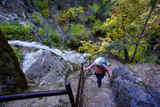
The trail is easy to follow as it winds around the mountain on the ascent. Desert plants like manzanita and yucca line the route, which is currently well-maintained but can be severely overgrown (long pants and sleeves are a good consideration for layering). There are two stream crossings.

Trail to Condor Peak in the San Gabriel Mountains

San Gabriel Mountains and a trail going to Condor Peak

As you hike, you’ll gain views of the Big Tujunga Dam to the east. After about 6 miles, you’ll spot the trail to Fox Peak heading up to the right, but you want to go left and follow the ridgeline of the Condor Peak Trail. This section is a bit of a rollercoaster, up and down, but eventually you come to the final hill to climb up. This last stretch of trail, about a quarter-mile long, is not as defined as the previous trails, but as long as you keep heading up, you’ll reach Condor Peak and find yourself completely surrounded by the western San Gabriels, including nearby Mount Lukens, the highest point in the city of Los Angeles.

NOTE: This is a long hike at 16-miles (round-trip). It's for experienced hikers who can manage the distance. Allow yourself plenty of time to do this hike and bring plenty of water and snacks. Directions to parking lot trailhead at 34.28907027332574, -118.22487016685561: From Downtown Los Angeles take the Glendale Fwy. (CA 2) North to I-210 West. Take Exit 11, and head east on Sunland Blvd. Turn left onto Oro Vista Ave. and continue onto Big Tujunga Canyon Rd. Stay on Big Tujunga Canyon Rd. for 6.7 miles and park in the dirt lot on your right. Once parked, you will cross the road to the trail and start your climb. Dog-friendly!

Story and photos by Breonna Carter, @mountainsquake

Trending Stories NorCal

View all Stories
  1. Serene Las Gallinas

    A serene stroll alongside marshland, passing ponds and grasses frilled in seasonal wildflowers, with Mount Tam a beacon in the background … how nice. As part of the esteemed Bay Trail, San Rafael’s Las Gallinas Valley Birding Loop and Wildlife Ponds comprises about 3.5 miles of wide-open trail.

    View
  2. Sponsored

    Redding Lights and Silent Nights

    Give your holiday events calendar a major glow up this winter in California’s sunniest city. Redding is a revelation: Surrounded by iconic scenery like Mount Shasta, Lassen Volcanic National Park, and Whiskeytown National Recreation Area.

    View
  3. A Hike to the Past

    This 5.2-mile redwoods hike through El Corte de Madera Creek Open Space combines a relaxing stroll with unique geologic formations and historical artifacts.

    View
  4. Hike at Olompali State Historic Park in Marin

    Historically Serene

    Olompali State Historic Park is a small park that packs big California history. Go on a mostly easy 3-mile loop hike where oak trees, big-leaf maples, and madrones are stunning in autumn.

    View

Trending Stories SoCal

View all Stories
  1. Woman swimming in Carson Hotsprings natural thermal pool

    Hot Springs, Naturally

    Thermal spring waters are famous for their curative, relaxing elements, and Reno Tahoe is filled with them! Sink into these amazing thermal respites for a wellness super soak.

    View
  2. A woman walks the path next to the beach at sunset at Palisades Park in Los Angeles County

    Santa Monica’s Most Beautiful Walk

    With its sweeping views of Santa Monica Bay and the Santa Monica Pier, the 26-acre Palisades Park, perched along the beach bluffs, may be a tourist’s delight for its quintessential California vibes–but it’s just as beloved by locals. Follow this 2.5-mile loop to experience it like one.

    View
  3. The Undead Ghost Town

    Every Halloween, the worlds of the living and the dead blur together. In the “living ghost town” of Randsburg that condition is permanent. This strange gold-rush town near the El P

    View
  4. Montebello Mission

    Adorable animal feeding, peaceful bird watching, and delicious beer drinking? Hello, Montebello! This northeastern city has fantastic views of the hulking San Gabriels and a variety of green spaces, not to mention great spots for beer(s)!

    View