Tamtastical Hike
Hike among the northern foothills of Mount Tam in Marin

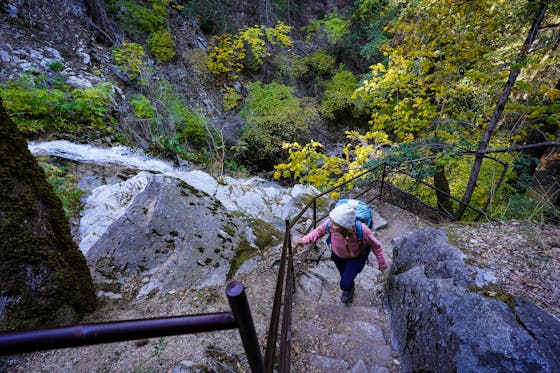
Stepping into the shadow of Mount Tam isn’t always about dramatic views of the mountain above. Sometimes it’s about noticing the small things. This 6.8-mile loop through the woods and ridges that make up the northern foothills of Tam offer the best of both worlds: solitude and grandeur.
Get an early start at the popular Deer Park Parking Area & Trailhead and follow the wide Deer Park Fire Road. The trail rises to a ridgeline through mixed forests, still dotted with the reds and yellows of fall. At the junction begin your descent on Shaver Grade Road to the shores of Phoenix Lake, one of the smallest of the five watershed lakes.
Continue your way around the lake, making sure to take in the open views of the water before heading up the hillside on the Gertrude Ord Trail. This singletrack trail completes the loop around the lake, but not before sending you over a bridge surrounded by pines and redwoods. As you emerge from the woods, take a left on Shaver Grade Road to begin your return. As you start your climb, keep an eye out for the signposts marking the Hidden Meadow Trail on the right.
Hop on the trail to add in the views that you might expect from being in Mount Tam’s shadow (you’ll know you’re in the right spot if you soon cross a little footbridge before entering a small meadow). The trail quickly rises to a wide-open ridgeline with big views of the valley below. At the next junction point, follow the signs straight ahead for Six Points Trail, which dips into a mixed forest grove. Finally, rejoin the Deer Park Fire Road and make your way back.
To reach the trailhead from downtown Fairfax, take Bolinas Rd. south for half a mile and turn left on Porteous Ave. Follow Porteous Ave. to the parking lot located on a sharp corner. There is limited parking, so arrive early to increase your chance of a getting a parking spot. Bathrooms are located at the trailhead (availability may change based on local regulations) but no water is available. There is a large map board at the trailhead that you can take photo of before starting your hike. Dog-friendly!


