Walking with the Devil

Devils Slide Trail Storm Hike

{NOTE January 2024: Due to rains, before visiting this spot check ahead for any road and trail closures and/or hazards before heading out, and exercise good judgement for overall safety.}

It used to be a treacherous stretch of highway. Today it’s a beautiful stretch of paved trail, perched high and hugging some of California's most scenic coastline. The Devil's Slide section of the California Coastal Trail is a 1.3-mile (one-way) multi-use path just south of Pacifica. It's usually much less crowded when gray skies and rain are around. And it's a prime spot for viewing all that's wild about the weather and the sea.
devilsslidelookout_lrg-image-jpeg

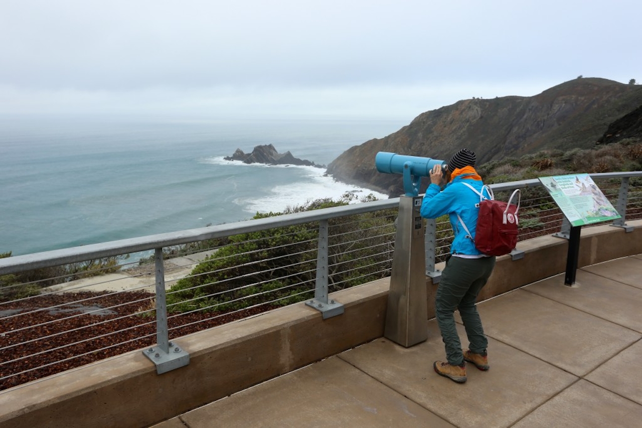
Bring your raincoat and start on the out-and-back asphalt path. Follow the path as it meanders and curves to huge cliff-hugging views of the Pacific, Pedro Rock, and numerous sea stacks and small islands often thrashed by storm-swelling waves. You're high enough to observe the drama safely and can take a closer look via an on-site viewing telescope (50 cents, please). Benches and informational placards pepper the pathway. Aside from the rumble-tumble of the Pacific, keep an eye out for jutting Egg Rock, home to the once endangered common murres now making a comeback due to conservation efforts. You'll also see the precipitous and off-limits stairway cutting up and into the side of a hulking cliff that was once a strategic military surveillance base. Return the way you came.

Map. Park at the Devil's Slide trailhead north parking lot, off Hwy. 1 just before the Devil's Slide Tunnel, heading southbound (there's another trailhead and parking lot at the southern end of the tunnel). Make sure to arrive early on weekends; the lot fills up quickly.

Trending Stories NorCal

View all Stories
  1. Woman with her arms outstretched to the rolling hills scenery while on a rock outcrop at Barnabe Peak in Samuel P Taylor Sate Park in Marin

    Barnabe Bonanza

    Sure, there are higher mountains in Marin (Mount Tam) and easier ascents (Mount Burdell), but is there a more expansive North Bay view? Barnabe Peak in Samuel P. Taylor State Park offers a glorious panorama including Mount Tam, Mount Diablo, and Mount St. Helena.

    View
  2. Hiker on the SCA trail in Marin Headlands with view of the Golden Gate Bridge

    Headlands Over Heels

    People come from all over the world to get a glimpse of the Golden Gate Bridge. Get a dramatic and novel view of the bridge without all the people on this moderate 6-mile hike in the Marin Headlands.

    View
  3. Cheers to Chimney

    If you’re looking for all that Point Reyes has to offer in spring, Chimney Rock is the place to be. The 1.75-mile (round-trip) hike to Chimney may be short, but it packs a visual punch, quadrupling the viewing thrills during spring.

    View

Trending Stories SoCal

View all Stories
  1. Woman hiking the San Onofre Bluffs Loop Trail to San Onofre State Beach in San Diego County

    Bluffing Good!

    Lovely coastline, beautiful beaches, unique geological history, and picturesque sandstone cliffs with limited foot traffic in San Diego County? Head to San Onofre State Beach and the 5-mile San Onofre Bluffs Loop Trail.

    View
  2. Can We Get a Whoop Whoop!

    City, mountain, and ocean views all in one hike? Whoop whoop! It’s no surprise the the Kenter Fire Road and Whoop-de-Doos Trail (a combo of fire road and singletrack) is a favorite among local mountain bikers and hikers alike.

    View
  3. The Big Chill

    In LA, finding a place to chill can be the ultimate flex. So flex, in Franklin Canyon! This unexpected oasis has plenty of shade, cool lake breezes, and ample picnicking spots. Enjoy it on an easy-going 1-mile stroll along its reservoir and duck pond.

    View





